Drilling Technology
The Art (and Science) of Drilling: Journey through a many-layered past
Global July 31, 2023 - By
Aramco has collaborated with technology providers to develop new measurement-while-drilling tools with sensors that can see at least 200 feet into the rock.
What if you could visit the past to plan your future?
That is exactly what an intrepid team of engineers from Aramco’s Petroleum Engineering and Development (PE&D) organization is doing — by employing recent measurement advances to drill new oil wells through layered rock known to geologists as “clastics.”
The history of any oil-bearing formation is geologically recorded in the different layers of rock, so it is essential for petroleum engineers, geologists, and other professionals in our industry to learn as much as possible about the composition of these layers. To achieve this, they use special tools to measure the different properties of the rock.
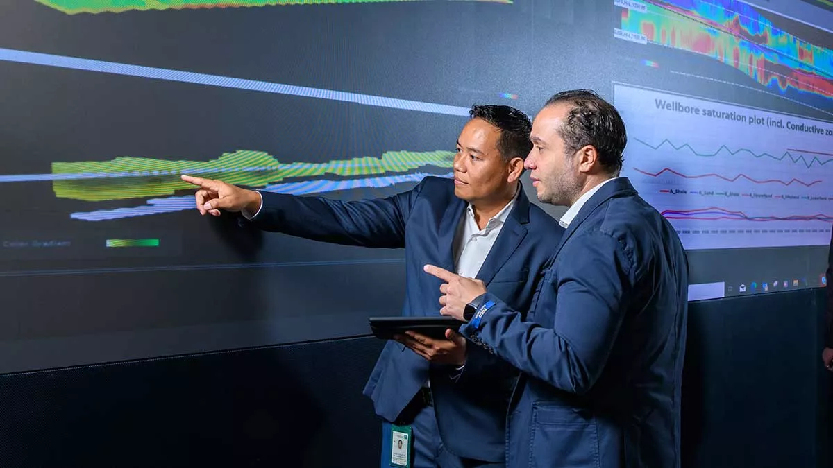
Until recently, geoscientists had to rely on measurements acquired from only a few inches into the rock around a newly drilled wellbore to create digital maps of the surrounding formation. That meant they could only “see” a short distance into the rock formation’s past.
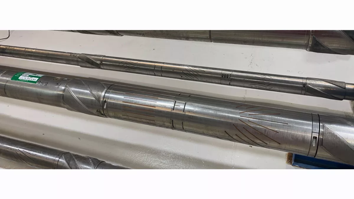
But Aramco has collaborated with technology providers to develop new measurement-while-drilling tools with sensors that can see at least 200 feet into the rock, in different directions around the drill bit.
As a result, Aramco’s geoscientists can now produce detailed maps of multiple layers (or “boundaries”) of rock formations, which have resulted in more efficient and profitable directional drilling operations.
Going deep
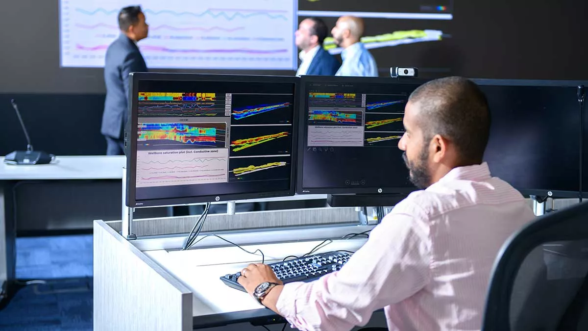
The team has developed a new data workflow for comparing different types of rock measurements — captured in real-time during horizontal directional drilling operations — with data collected from other wells already drilled nearby in the same formation. Such wells are known as “offset wells.”
The workflow includes a geological model that combines different measurements captured by the tool. Engineers and geoscientists can use these measurements to target oil-bearing rock layers in formations deep beneath the Earth’s surface.
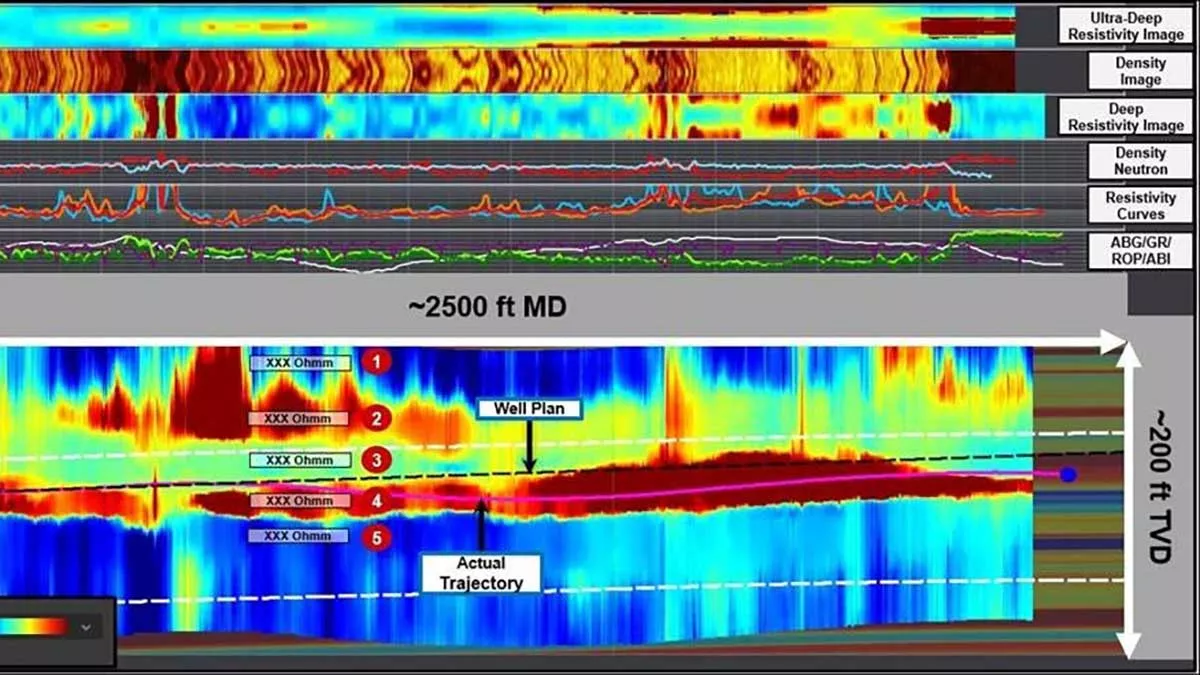
Collecting the data to build maps of the layers of rock in crude oil reservoirs, and the fluids they contain, is made possible by bed boundary mapping tool technologies, with service providers’ ultra-deep azimuthal resistivity tools being one of the key technologies used for this purpose by the team.
These particular tools were developed to meet Aramco’s specific requirements, and include innovative angled sensors — pairing transmitters with receivers — that can measure the “ultra-deep” properties of the formation as much as 200 feet from the wellbore; a distance known as the “far field.” The new workflow compliments the tools’ data gathering and management capabilities.
The project team has achieved impressive measurement and data-capture results from testing the tools. The team’s enhanced ability to create detailed maps of multiple layers of the reservoir rock from the data, from above and below the wellbore, is proving the operational and business benefits of the new technology.
According to Rayan A. Ghanim, one of the Aramco team’s technical leaders, the new tools are enabling drilling teams to pinpoint the best rock layers through which a new well should be drilled. “This capability will help to reduce the cost of oil production over the long term,” he said.
Making the good even better
The Aramco project team is now working to add new capabilities to the sensors, geological model, and data workflow. This will further enhance Aramco’s geosteering toolkit, by ensuring drill bits can be guided more efficiently through formations, and so reduce the time and cost required to drill new wells.
Ida Bagus Gede Hermawan Manuaba, the team’s logging-while-drilling subject matter expert, highlighted the benefits of the new data workflow for Aramco’s business.
This is a significant game changer in the field of formation evaluation using petrophysics.
— Ida Bagus Gede Hermawan Manuaba
“It will help us understand the distribution of the oil in complex formations, optimize well placement planning, improve drilling and well completion designs, and make oil production levels more sustainable at a lower cost,” he said.
Ghanim added, “Use of the model and workflow, by combining data from offset wells with real-time drilling data, is in line with the industry’s drive toward greater digitalization and meeting the Kingdom’s Saudi Vision 2030 goals.” The team is now continuing further work to optimize the model and workflow as more data are collected from drilling wells.
This project clearly demonstrates Aramco’s technology leadership in directional drilling and highlights how the company’s engineers continue to plan for our future — by reading the past.
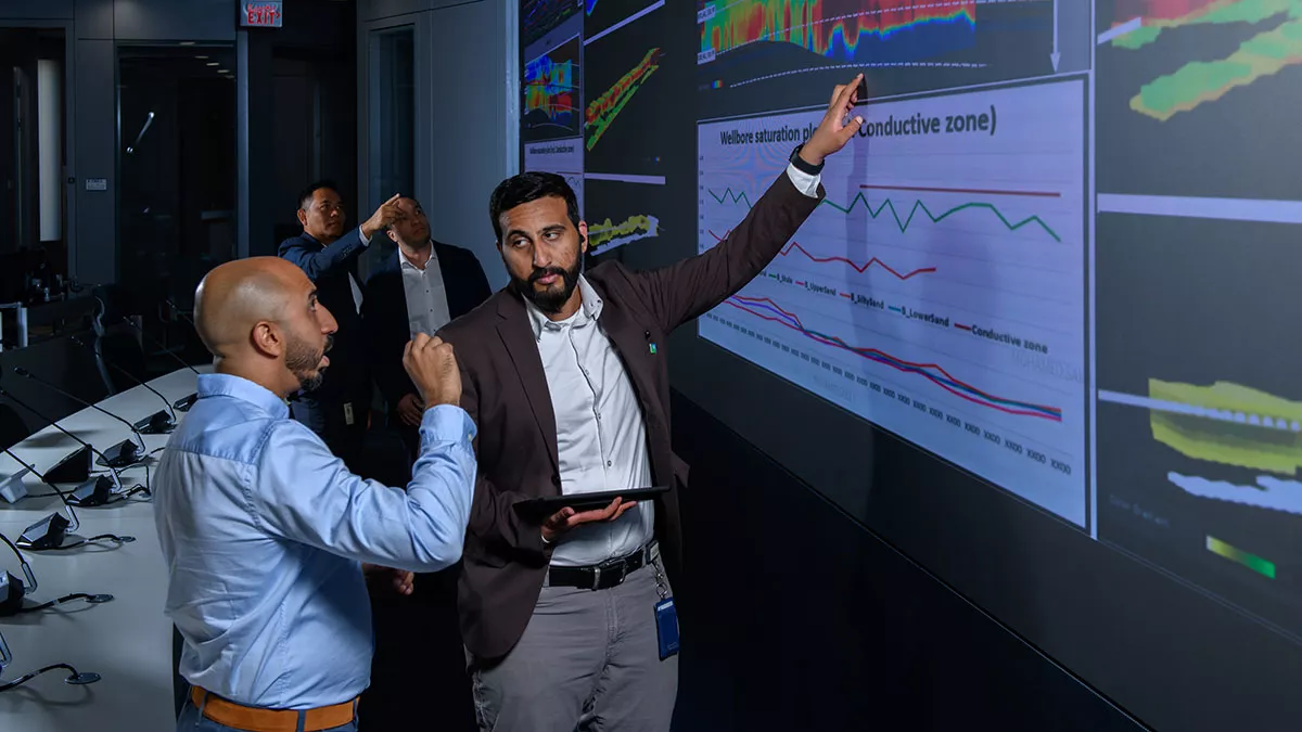
Caption for top photo: Abdullah A. Alshehri (right), of Aramco’s Reservoir Description and Simulation Department, discusses real-time far field data mapping at Aramco’s Geosteering Center in Dhahran. (Photo: Zainab M. Alnaboud/MPD)


