Eye in the sky
Mapping coral reefs and detecting oil spills with satellites

Global April 01, 2019 - By
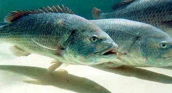
Coral reefs are home to thousands of marine species in the world, and they play a vital role in the global economy by providing resources and services worth of billions of dollars yearly.
These ecosystems are highly sensitive to environmental changes and can show signs of distress in response to detrimental conditions almost immediately. For this ability, coral reefs are considered to be an indicator for the health of the world’s oceans. Nonetheless, coral reefs are currently disappearing worldwide at an alarming rate due to natural and anthropogenic factors, and scientists are fighting to stop this trend.
In order to protect these ecosystems, the first step we need to complete is to know where coral reefs actually are.
Global maps of the distribution of coral reefs have gone largely unchanged since the 18th century from data collected during ocean expeditions, and it was not until recently that coral reef mapping met the modern technology with the arrival of the Landsat 7. The Landsat series of satellites were originally created in 1972 to observe landforms, but version 7 that emerged in the turn of century had a special focus on marine environments, thus allowing the collection of images on marine ecosystems that lead to the Millennium Global Coral Reef Mapping project (NASA Earth Observatory, 2015). Led by the Institute for Marine Remote Sensing at the University of South Florida, this project used a dataset of high-resolution (30 meter) Images, acquired between 1999 and 2003 from the Landsat 7 satellite, and developed the first global uniform map of shallow coral reef ecosystems, in collaboration with the United Nations Environmental Programme World Conservation Monitoring (IMaRS-USF, 2005).
A new generation of satellites (Landsat 8) has improved coral reef mapping, and the current sensors aboard have higher sensitivity, and can simultaneously collect important data (such as sea surface temperatures) to monitor coral reefs, even in the most remote regions. Emerging applications from new satellite capabilities was the creation of the National Oceanic and Atmospheric Administration (NOAA) Coral Reef Watch. This program uses satellite data to provide current reef environmental conditions to quickly identify areas at risk for coral bleaching. Bleaching is the process by which corals lose the symbiotic algae that give them their distinctive colors. If a coral is severely bleached, diseases can attack them, leading to coral death.
Satellites have improved our knowledge on coral reefs, and that technology is currently shaping management decisions, by collecting near-real time information on multiple environmental variables around these ecosystems that cannot be obtained by in situ observations (Eakin et al. 2010). There are still some gaps with existing satellite technology, as they don’t provide images that provide the level of quantitative and qualitative data, necessary for creating comprehensive maps of living coral reefs, or detecting changes in their health on a global basis (Planetary Coral Reef Foundation 2012). For these reasons, in 2010 The Coral Reef Satellite Mission (CRSM) was launched by The Planetary Coral Reef Foundation, in collaboration with MIT’s Center for Space Research, and The Science Operations Center at Scripps Institution of Oceanography, to daily transmit real-time data, about the state of the world’s coral reefs, back to Earth. The global baseline map of coral reefs produced by the CRSM facilitated the discovery of hidden reefs and changes to their health.
Recent advances and applications on satellite technology have been targeted to detect marine oil spills, due to the threat they pose to the economy and the environment. For instance, the satellite Sentinel has been launched for environmental monitoring, specifically for response to natural disasters, including oil-spill monitoring as well as ship surveillance (ESA 2017). This satellite has Synthetic Aperture Radar sensors (SAR) that provide high-resolution images (20m) independent of weather conditions, and allow the identification of oil slicks due to the disruption of ocean backscatter. Ideally, SAR satellite images are used to detect any oil slick that can result from illegal dumping, sabotage incidents, operational failures, etc. Combining SAR technology with an integrated environmental modeling system can be used to remotely track and forecast the spill’s Fate, to ensure making the required informed decisions to safeguard people, assets, and the natural environment. The integration of these tools assists the surveillance activities of concerned environmental and governmental organizations. This technological approaches can potentially enable Saudi Aramco to better respond to oil-spill incidents by providing an accurate and proactive oil spill monitoring system. Satellite-based monitoring provides broad advantages, such as rapid spill identification, near real-time imagery for oil spill impact management, and threat assessments.
While many of these advances on oil spill detection for coral reef protection are promising, there are still gaps that need to be filled. For instance, the current technology only allows users to map coral reefs, inform about changes in the environment around them and detect onsite oil spills. To help better manage and protect the marine environment and its resources, this technology should be integrated with modelling capabilities that allow for the prediction in real time the direction of oil spills to anticipate our responses and minimize impacts. Saudi Aramco has recently triggered the establishment of in-house environmental modeling capabilities, to improve and enhance its modeling capabilities in both the Red Sea and the Arabian Gulf. This modelling will be ready for operation Companywide by 2021. We are looking forward to integrating these modeling capabilities with SAR technology, as part of our oil spill response capability.